
News » La Nina Moves In For The Winter
La Nina Moves In For The Winter
See what it means for weather in your region
NOAA, November 9, 2017
A La Nina climate pattern has arrived and is likely to persist through the winter, according to an advisory issued by NOAA’s Climate Prediction Center today. Scientists say there is a greater than 50-percent chance La Nina will also be in place February through April 2018.
This is the second winter in a row with a La Nina, and like last year, forecasters expect this one to be weak. Last year, this weather phenomenon extended from July 2016 to January 2017 before a return to neutral El Nino Southern Oscillation (ENSO) conditions.
La Nina: What it is, and what can we expect
La Nina (translated from Spanish as “little girl”) is a natural ocean-atmospheric phenomenon marked by cooler-than-average sea surface temperatures in the central Pacific Ocean near the equator, the opposite of El Nino (“little boy”).
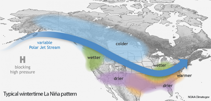
Typical La Nina patterns during winter include above-average precipitation and colder-than-average temperatures along the northern tier of the U.S. and below-normal precipitation and drier conditions across the South. NOAA’s 2017 Winter Outlook anticipated that a weak La Nina was likely to develop. Therefore, significant changes are not expected when the Winter Outlook is updated on November 16.
Comments
No one has commented on this page yet.
Post your comment